50th Anniversary Trip - Death Valley National Park


Advertisement
Published: January 28th 2018
Edit Blog Post

The Titus Canyon RoadThe Titus Canyon RoadThe Titus Canyon Road

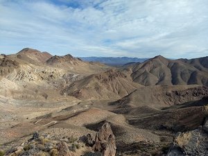
Looking back from along the trail, you can make out the road as it winds its way up through Titanothere Canyon to Red Pass.
Monday, 12/25, Christmas.Drove down the very rough, curvy, dirt and gravel Titus Canyon Road to Red Pass and the trailhead for the Thimble Peak hike. The trail was about 2.5 miles long, one way, with an elevation gain of around 1,200 feet. With several significant ups and downs, the net elevation gain was more like a very strenuous 1,800 ft. The summit of Thimble peak is 6,381 ft. above sea level and is the highest point for miles around, thus the views were breathtaking in every direction. Probably the best hike of our trip. After returning to our car, we drove on down the twelve miles of even rougher, curvier road through Titus Canyon. Just to make things interesting, two minutes after starting down the road, a low tire pressure warning popped up on the info screen in the car. So we drove nervously and slowly down the road, watching the tire pressure go down from 22 psi to 18 psi by the time we finally made it to Stovepipe Wells where we would spend the night. Fortunately the general store there had an air compressor so we could re-inflate the tire.


Tuesday, 12/26. Up fairly early and
Thimble Peak TrailThimble Peak TrailThimble Peak Trail

On the way up. Had to stop to take a lot of pictures, not because I was tired, but because there was always a new view try to capture.
checked the tire. It was back down to around 17 psi so, after reinflating it to around 40 psi, drove back to Beatty to have the tire repaired. Fortunately, the problem was a nail that could be repaired, and we did not have to buy a new tire. After that we drove to the Golden Canyon Trailhead. We hiked about 6 miles around the Golden Canyon, Badlands Loop, and Gower Gulch trails going from around sea level to the highest point of around 800 ft. along Badlands Loop. After this hike, we drove on down to Badwater Basin, the lowest point in North America at 282 ft. below sea level. We had visited this same spot with our children in the early 90's and at that time, it was deserted, with nothing but a sign indicating the significance of the site. Boy was this time different! Now there is a well developed access walkway leading out into the desert with interpretive signage and about 100 thousand people. We did not tarry. After taking a picture or two, we drove back to our room in Stovepipe Wells.


Additional photos below
Photos: 23, Displayed: 23


Advertisement

Thimble Peak TrailThimble Peak Trail
Thimble Peak Trail

From the saddle just before the final climb. The trail to the top is to the right and sort of zig zags up the right side of the slope.
Thimble Peak TrailThimble Peak Trail
Thimble Peak Trail

One of the steeper sections near the summit.
Boots Boots
Boots

From the summit.
From Thimble Peak summitFrom Thimble Peak summit
From Thimble Peak summit

From the summit looking south toward the valley. This was taken with the digital camera. Check out the difference on the next picture of the same scene
From the summitFrom the summit
From the summit

Another looking south with Death Valley in the distance. This was taken with our new smart phone's camera.
From the summitFrom the summit
From the summit

Looking East I think.
On Thimble PeakOn Thimble Peak
On Thimble Peak

Another peak bagged.
From the summitFrom the summit
From the summit

Looking southwest.
SelfieSelfie
Selfie

On the summit
From the TrailFrom the Trail
From the Trail

On the way down.
Going downGoing down
Going down

A steep section near the base of the summit.
Sunrise over Stovepipe WellsSunrise over Stovepipe Wells
Sunrise over Stovepipe Wells

View from outside our room.
Another of the Sunrise Another of the Sunrise
Another of the Sunrise

From outside our room
Red Cathedral TrailRed Cathedral Trail
Red Cathedral Trail

The Red Cathedral Trail was a spur off of the Golden Canyon trail. Had several tight spots that required going under boulders.
Red Cathedral TrailRed Cathedral Trail
Red Cathedral Trail

At the end of the canyon that is the Red Cathedral the trail climbs a steep portion of the wall for this view.
Along the Golden Canyon TrailAlong the Golden Canyon Trail
Along the Golden Canyon Trail

The tall formation in this picture is called Manly Beacon, named for John L Manly who guided members of an ill-fated '49er pioneers out of Death Valley during the gold rush of 1849.
Looking west on the Badlands Loop trailLooking west on the Badlands Loop trail
Looking west on the Badlands Loop trail

The Badlands Loop trail branched off of and climbed above the Golden Canyon trail to just below Zabriskie Point. That's Manly Beacon on the right.
Zabriskie PointZabriskie Point
Zabriskie Point

Zabriskie Point, named for the president of the Pacific Coast Borax Co., is the high point, with the Black Mts. behind it.. Badlands Loop trail travels below it, from left to right in the picture.
Gower GulchGower Gulch
Gower Gulch

The Gower Gulch trail as it exits the gulch and rounds the curve going to the trailhead parking area.
Badwater BasinBadwater Basin
Badwater Basin

Lowest Point in North America at 282 ft. below Sea Level. Lots of people there.
Stairs to the Badwater Basin parking area.Stairs to the Badwater Basin parking area.
Stairs to the Badwater Basin parking area.

The arrow points to a sign that marks sea level, 282 feet up the cliff.


Tot: 0.062s; Tpl: 0.01s; cc: 11; qc: 28; dbt: 0.0238s; 1; m:domysql w:travelblog (10.17.0.13); sld: 1; ; mem: 1.1mb